


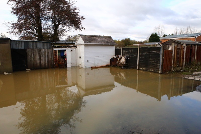
GYPSY families who say they lost everything in last week’s floods have called on Barnsley Council to think twice about placing them on sites in known flood plains.
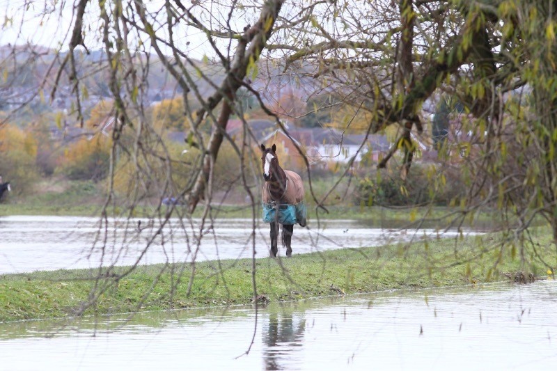
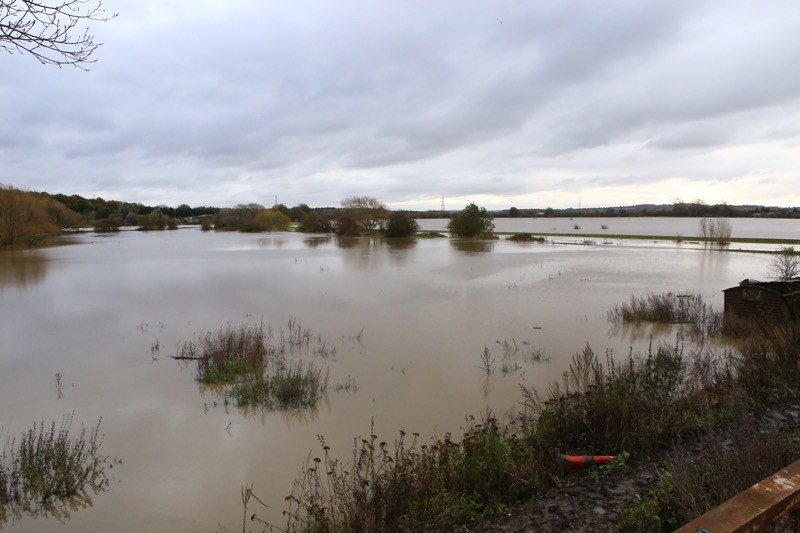
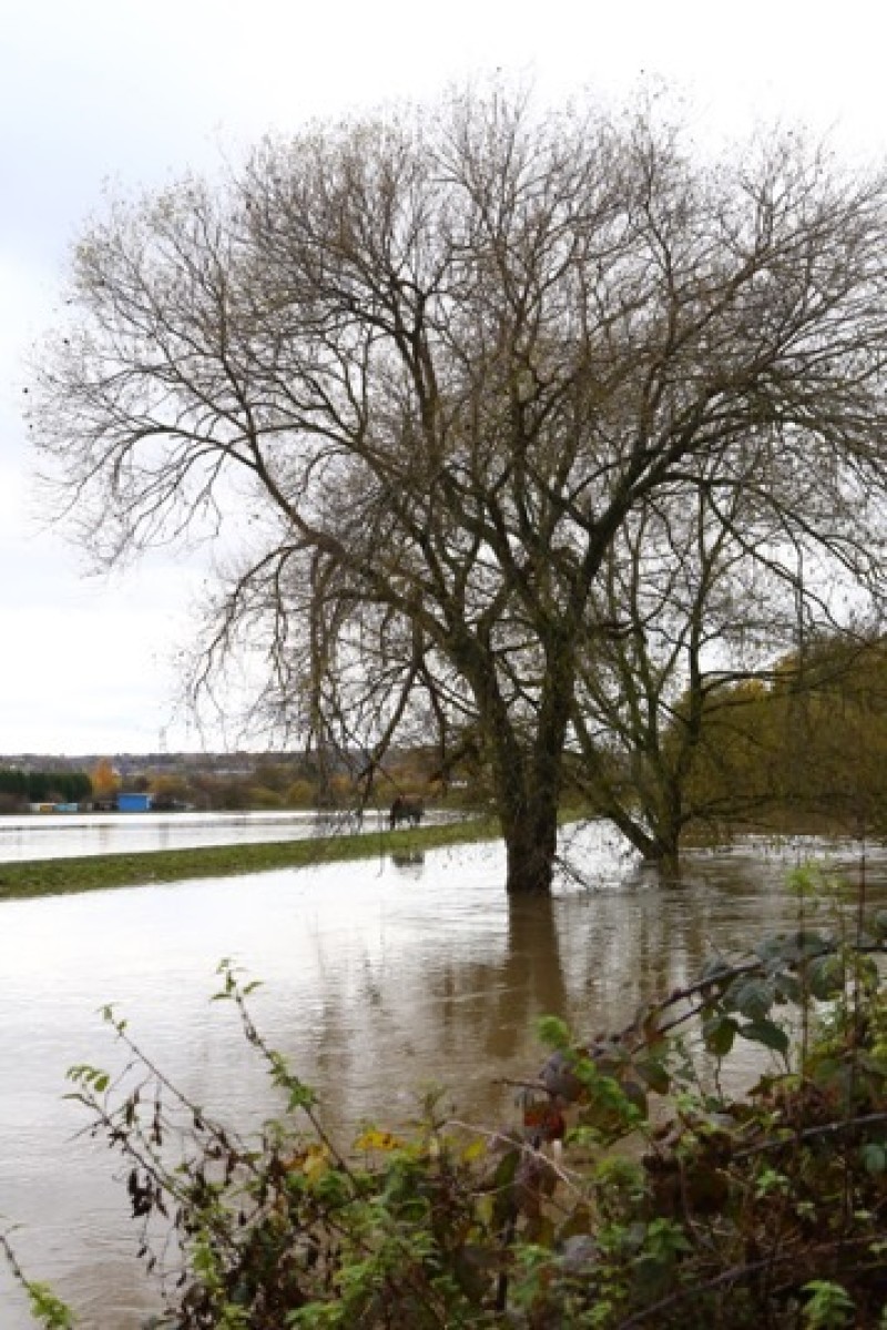
Wombwell Ings’ gypsy site, which is bordered by the River Dearne and River Dove, also skirts Bulling Dike and all three swamped the land which was occupied by more than ten families.
Flood water came ‘from three sides’, according to witnesses, and started taking hold on Thursday evening and forced dozens of people to abandon their chalets.
Dennis Taylor, who lives on the site, told the Chronicle: “Everyone’s lost everything - we’ve been cleaning up what we can but it’s been absolute bedlam since the flooding started.
“To be fair to the council they’ve done a lot for us this week but gypsies always seem to be pushed out into the worst areas - which are known for flooding - and it isn’t acceptable. Every single time it rains we’re panicky as it’s happened in the past and once again we’ve lost everything as a result.”
A six-figure project - dubbed Wings Across The Ings - has been taking place throughout 2019, delivered by The Garganey Trust, which has focused on improving wildlife habitats and providing ‘greater flood risk protection’ for local residents through a new waterway channel and bund system, which includes the gypsy site. Another family on the site - the Smiths - sought to move to a field off Middlecliffe Lane, Little Houghton, citing fears over flooding but consent to create 11 pitches was refused last year after more than 100 residents objected.
At the time, a council report said: “The applicant’s very special circumstances case is disagreed with. The assertion is made that concerns about flooding at the Wombwell Ings site does not take into account the flood defence work that has been carried out in that area since 2007 and that there has been no flooding since.”
Mr Taylor added that the so-called flood improvement work hasn’t had the impact residents wanted and that the majority of Barnsley’s permanent gypsy sites in Wombwell, Brierley, Smithies, Grimethorpe and Royston, were prone to similar issues.
“The work hasn’t helped us otherwise we wouldn’t be in the same position as we found ourselves in, battling flood water as we did 12 years ago,” he added. “We’re automatically pushed away into sites prone to flooding and then left to pick up the pieces.”
According to the council’s local plan - which sets out development and accommodation needs up to 2033 - officers indicated that families wanted to live further away from development.
It said: “In allocating sufficient sites to accommodate gypsies and travellers in Barnsley, the council considers that land allocated in the local plan must be acceptable in sustainability terms, satisfactory to both the settled and travelling communities and capable of being delivered within the plan period. The council has used a robust process for the assessment of potential sites that has allowed for a comparison of the relative merits of each site so that an informed professional decision can be made on the most appropriate sites to be allocated. (
“Although contrary to the principles of both national and local planning policy, the experience of the council’s gypsy and traveller liaison officer indicated that families had a preference to live more remotely from existing settlements.
“This has informed the site assessment process in order to ensure the principles or integration are promoted while meeting the preferences of both the gypsy and traveller and settled communities where possible.
“There is generally a presumption against most forms of development in areas of high flood risk unless there are no other suitable sites available. Caravans should not be located in areas at high risk of flooding.”